Naviter Oudie N fanet+
Naviter Oudie N fanet+
Couldn't load pickup availability
Oudie N - the new guy in the game
The world's most popular portable navigation solution. With the Oudie N, you can take your flying to the next level. Gone are the days of relying on outdated weather information and cumbersome flight planning tools. The Oudie N delivers up-to-the-minute data in real time and integrates seamlessly with SeeYou to provide you with a complete cockpit solution. With the Oudie N, you can focus on the joy of flying while staying safe and informed. So why settle for less when you can take to the skies with the Oudie N?
Features and benefits
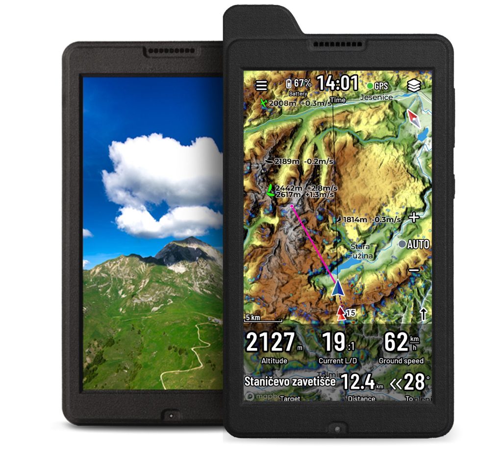
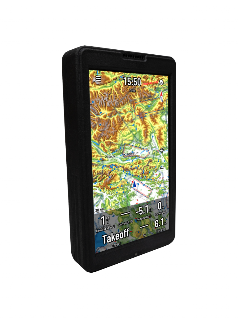
- Crystal clear, Readable even in sunlight Display.
- Exceptional battery capacity even at full brightness.
- Easy-to-use SeeYou Navigator software.
- Backup Vario function .
- Wi-Fi, Bluetooth and 4G/LTE Connection options .
- Optimize Cross-country and competition tasks perfected to perfection.
- Scan QR codes instead of manually entering tasks.
- No internet connection? No problem with the Offline maps .
- Charge your smartphone after landing using the Oudie N's battery .
- Free 1-year subscription from SeeYou (Cloud) for seamless integration
Compare platforms
Android & iOS Phone
✅ Navigate
✅ Avoid airspace
✅ Record a flight
✅ Live weather
✅ Upload to OLC
✅ Much more >
Oudie N Glider
All functions of the smartphone software and additionally:
✅ Backup Vario
✅ Large battery
✅ Sunlight-readable LCD display
✅ High-precision sensors
✅ One year of SeeYou usage included
Oudie N IGC
Everything from the Oudie N glider and additionally:
✅ IGC approval for (world) records
✅ Eligible for all competitions
✅ Engine noise recording for self-starting engines and turbos
✅ ENL for combustion engines
✅ ENL for electric drives
Further information
SOFTWARE
Navigation app SeeYou Navigator
SeeYou Navigator upgrades are included for the entire lifetime of the device.
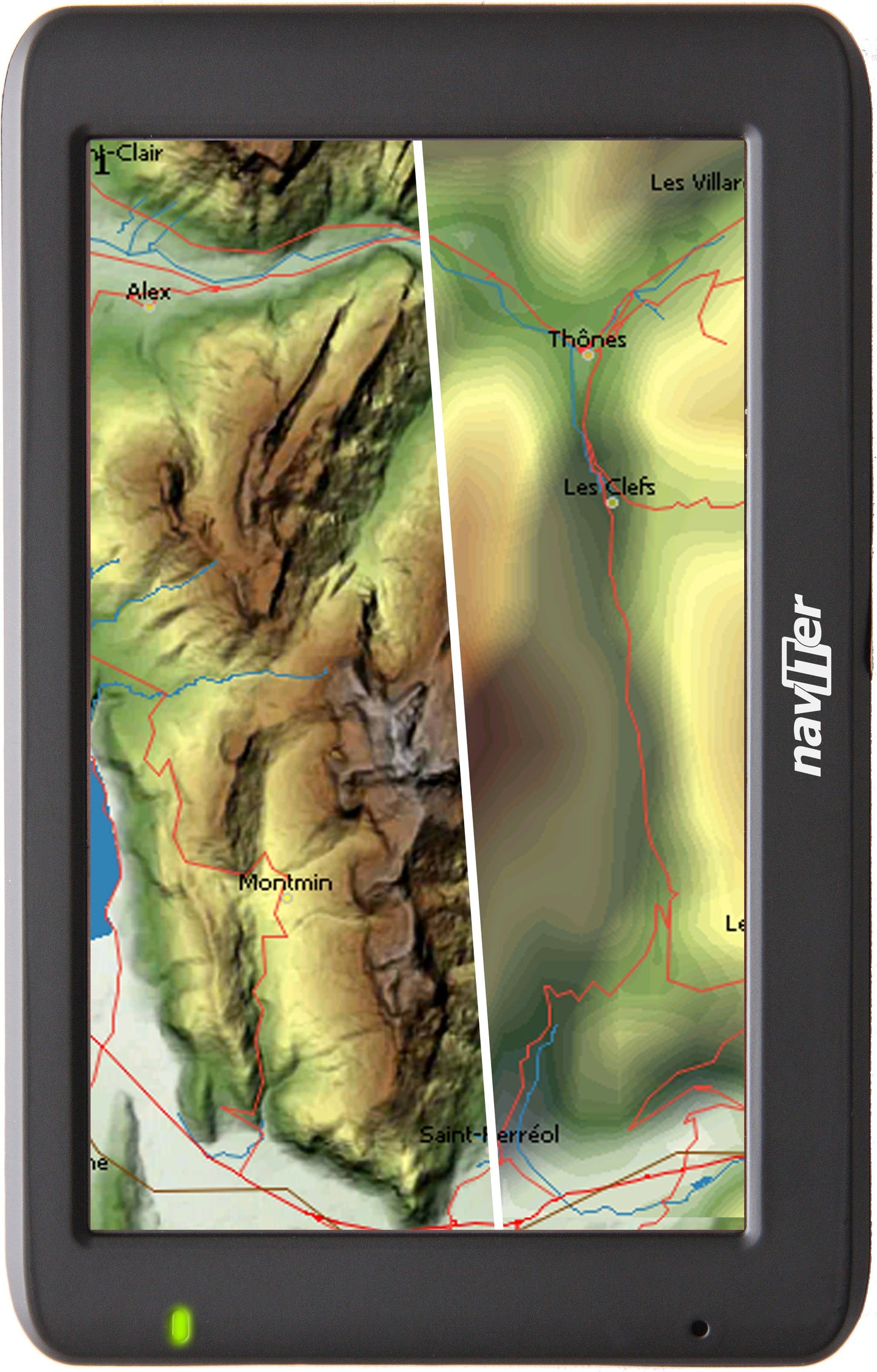
Maps Worldwide, high resolution
Details down to street level
Site color scheme (SeeYou standard)
Outdoor scheme
Light scheme
Satellite maps (Internet connection required)
Download maps for offline use in advance to reduce download size.
Cross-country flight task
Racing Task Competition Tasks
Assigned area task Competition tasks
Elapsed Time Tasks
Free flight
Select a task from Soaring Spot
Scan a task QR code
Connectivity: Connect external devices using Bluetooth Low Energy
Flarm Bluetooth dongle
LXNAV Bluetooth dongle
Condor Bluetooth dongle
Functions: Record flight path (IGC file)
Airspace warning
Thermal assistant
Final approach calculation
Route optimization
logbook
Airfield database
Airspace database
Load custom airspace file
Fully configurable map screen
Automatic airspace update
Pinch-to-zoom
Online functions Rain radar
Open Glider Network (OGN) coupling
KK7 Skyways and Thermals
TopMeteo weather link
SkySight weather coupling
TopMeteo live satellite image
SkySight live satellite images
Upload to online competitions
Seamless integration of SeeYou.Cloud
Seamless integration with Soaring Spot
Automatic airspace update
Automatic database update
Share